Natural-language spatial queries
Ask questions in plain English. The agent writes and runs the PostGIS query for you.
Geospatial software · 3D visualization · AI
We turn drone surveys, LiDAR, BIM, and GIS data into interactive 3D web applications and site visualizations. Your clients and stakeholders can open them with a single link.
What we're building
Canonica is building AI-native geospatial software that combines large-scale spatial data, 3D visualization, and AI agents. We are initially validating the technology through client projects in surveying, civil engineering, architecture, and urban planning.
Ask a question about your site in plain language.
The agent plans the analysis and runs it in PostGIS.
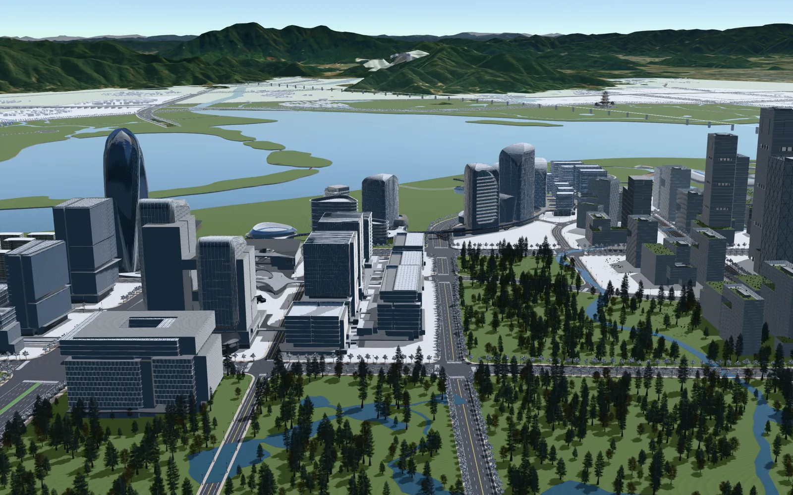
Results appear in a CesiumJS scene, with the query shown alongside.
Which parcels are within 200 m of the 100-year floodplain?
plan → spatial query → render
SELECT p.id, p.area
FROM parcels p
JOIN floodplain_100yr f
ON ST_DWithin(p.geom, f.geom, 200);Geospatial AI capabilities
Ask questions in plain English. The agent writes and runs the PostGIS query for you.
Buffers, overlays, distances, and elevation, with coordinate systems handled correctly. The model plans multi-step analysis through tools instead of guessing.
Results appear as layers in a CesiumJS scene, on top of terrain, 3D Tiles, and BIM models.
Drone, LiDAR, BIM/IFC, and GIS data unified in PostGIS and 3D Tiles, so the agent works on real project data.
Built on tool calling and MCP, working with Claude, GPT, and Gemini. Each task uses the model that fits it best.
Every answer shows its query and source layers. Your data stays in your environment.
Who we work with
We validate every capability on client work. We deliver 3D web applications today and add AI where it saves real time.
Deliver photogrammetry and LiDAR results as a branded web viewer, not large files your clients can't open.
Combine design models, terrain, and existing conditions in one 3D scene for reviews and approvals.
Show your projects in their real site context, with accurate terrain, surroundings, and parcels.
Compare design options, check sunlight and sightlines, and present plans to the public in an interactive 3D city.
Services
Custom browser-based 3D map platforms built on CesiumJS. We build the tools around your workflow, such as measurement, layer controls, attribute queries, cross-sections, timelines, and natural-language search powered by AI. No plugins or installs required.
We convert point clouds, photogrammetry meshes, BIM/IFC, and GIS datasets into web-optimized OGC 3D Tiles. Output is accurately georeferenced, compact, and streams quickly.
Renderings and flythrough videos made in Unreal Engine and Blender, built on accurate terrain and GIS data. Use them in design reviews, public meetings, and marketing.
We keep your viewer online, updated, and compatible with the latest browsers. New features are added as your needs grow.
Work
Real-time 3D scenes built with CesiumJS and Unreal Engine, from city-wide context down to individual landmarks.
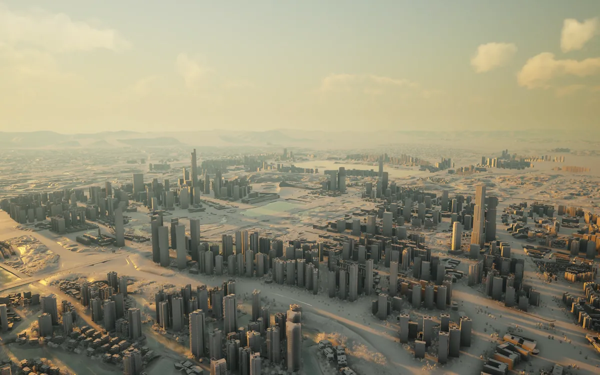
A whole-city massing model with its surrounding terrain, lit at golden hour to show skyline, density, and shadows at a glance.
Real-time rendering · Terrain · Lighting study
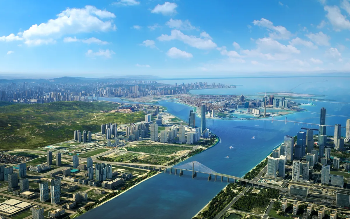
A photorealistic aerial view of a waterfront planning area, showing new development within its full regional context of terrain, water, and bridges.
Photoreal rendering · Regional context
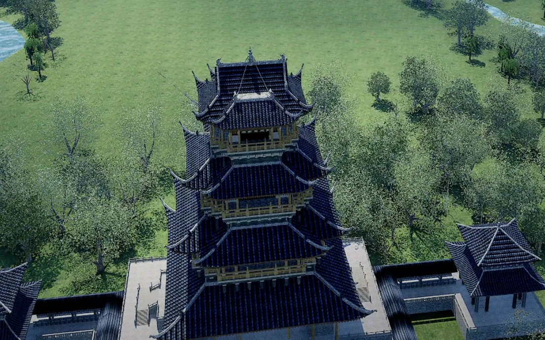
A detailed heritage landmark model streamed inside a browser-based 3D city scene, alongside vegetation and water. You can explore it in the browser without installing anything.
3D Tiles · Web streaming · Detailed modeling
Process
We review your data, goals, and audience. The call is free and takes 20–30 minutes.
You get a fixed-price or hourly proposal with clear deliverables, milestones, and a timeline.
You get a live staging link early and see progress every week.
Final handoff with source code and documentation. Monthly hosting and maintenance are optional.
Projects typically start at $2,000.
Tools we use
About
Canonica is a geospatial technology company building AI-native software for spatial data. It was founded by Kailong Liao, a geospatial developer with 8+ years of experience in GIS data processing, 3D web development, and real-time visualization.
Kailong has built large-scale 3D GIS platforms for urban planning and infrastructure projects, covering every stage from raw data processing to the finished web application. That experience is now the foundation for AI-native geospatial software.
FAQ
We work with LAS/LAZ, E57, OBJ, FBX, glTF, IFC, OSGB, Shapefile, GeoJSON, GeoTIFF, and most other common survey and design formats. If you're not sure, send us a sample.
You do. Once final payment is made, all project deliverables and source code are transferred to you as set out in our agreement.
We're happy to sign an NDA before reviewing any data. Client data is used only for your project, and it is deleted or returned when the engagement ends.
We work remotely with clients across the US. We're available for calls from 8 to 11 AM US Eastern and communicate by email, Slack, or Microsoft Teams. You receive a written progress update every week.
Yes. We regularly pick up, debug, and extend existing CesiumJS applications.
It is in development. We already use its components, such as natural-language queries over PostGIS, in client projects, and we welcome early-access partners who want to shape it.
We work with Claude, GPT, and Gemini through business APIs that do not train on your data. We're happy to sign an NDA, and the agent can run against a database in your own environment.
We invoice by milestone or monthly. You can pay by ACH, wire transfer, or card.
Contact
Tell us about your project. We reply within one business day.
Or email us directly:
hello@canon-map.org